Much of my research is focused on the problem of the origins of primary states from a context of interacting pre-state societies. On the one hand, in my work at the Santa Fe Institute, I am trying to develop new theoretical constructs that will show how such pre-state and early state formations worked and that will explain the emergence of states. On the other hand, I am leading or facilitating field projects in several areas of the world where primary states did emerge, in order to assemble the evidence needed to evaluate such theoretical constructs. Let me discuss some of these field projects first.
Mesopotamia
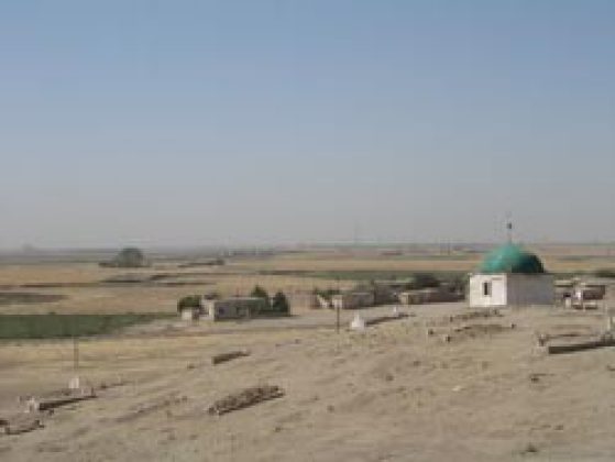
From a cultural point of view, Mesopotamia includes not only the land between the Tigris and the Euphrates but the surrounding deserts, foothills and mountains, including parts of the modern countries of Iraq, Iran, Syria, and Turkey. It is the homeland of the world's oldest experiments in statecraft, which we now know occurred during the Early Uruk Period, about 4000 BC. I first began working here in 1965, and have since worked on excavations and surveys with many colleagues to develop regional data bases on changing environments, populations, settlements, social groups, foodways, crafts, trade, conflicts, and symbolic life between 4500 and 2500 BC (above, view of Eastern Syria near Tell Brak Cemetery is on a cultural mound, 2000 BC) .
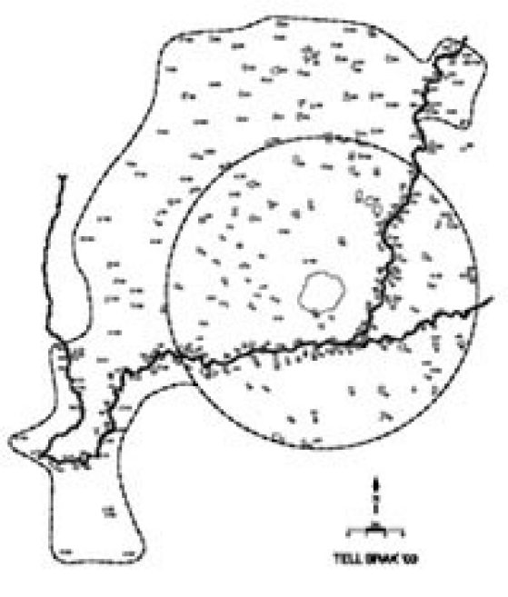
My recent work has been with with the British project at Tell Brak in the dry-farmed wheat belt of Eastern Syria. This long-term work has been directed by David and Joan Oates under the aegis of the McDonald Institute of Cambridge University. From 1998 until 2002, I helped with the excavations at Tell Brak itself of layers of the IVth millennium BCE under the field direction of Geoff Emberling and Helen McDonald. From the autumn of 2002 until 2005, as part of the Brak project and with the cooperation of Syria's excellent Department of Antiquities, I have directed an archaeological survey of the sustaining area around Tell Brak (to left, survey map, October 2003). Since then I have been visiting Syria whenever possible to work on the pottery from the survey.
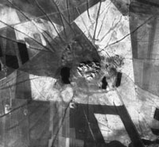
With intensive surface examination assisted by satellite imagery, our teams have to date covered all the land within 15 km of Brak, and recorded more than 400 archaeological sites, ranging in age from Paleolithic to early modern times (to right, satellite image showing central citadel, the outer suburbs and many roads [600–1500 BC] radiating from town. ©J. Ur). The most striking result so far is the explosive growth of settlement about 4000 BCE, just as the excavations at Brak indicate that the center was becoming a differentiated urban center with evidence of both economic and political specialization. Continued research here, and elsewhere in Mesopotamia, depends on the political situation.
Madagascar

I first visited Madagascar in the western Indian Ocean in 1975, drawn by the rich ethnohistorical accounts of indigenous state formation during the 17th and 18th centuries. I was shown extraordinary archaeological landscapes in the central highlands around the capital of Antananarivo (to left, Andrianampoinimerina, state founder). I was impressed to learn that, using conventional air photographs, archaeologists at the Musée d'Art et d'Archéologie had located more than 16,000 sites in 'Imerina,' the heartland of state formation in the vicinity of the capital, and had done a number of high-quality excavations in this area. It was clear that archaeology could produce evidence of the cultural processes that the traditional histories rarely discussed—such as changing environments, populations, settlements, agriculture, crafts, trade, and warfare, and that the traditions could provide evidence about social groups, politics, ideology, and other issues archaeologists can document only with great effort and expense.
With the colleagues from Musée and supported by the U.S. National Science Foundation, teams from Ann Arbor began intensive regional surveys and small site excavation in 1983. I have taken much time off from the work in the central highlands to help Malagasy colleagues and students working on the coasts, and we now have an island-wide archaeological framework. In Imerina, we have a sequence of seven cultural phases from the pioneering villages of AD 1200 until state consolidation in AD 1810. The dense hierarchical regional organization of the first state, ca. AD 1790, showing its capital, Ambohimanga, its provincial centers, small centers, villages, and hamlets, can be closely correlated with traditional accounts of the first state ruler. This has recently been published as a University of Michigan Museum of Anthropological Archaeology Memoir and we are now studying the kingdom to the west of Ambohimanga, a key player in the state forming process. (Photo, survey landscape in Eastern Imerina; map, settlements occupied between 1760 and 1810 AD [in red], the time of state emergence.)
Much remains to be done, both in Imerina (where the renewed growth around Antananarivo is threatening many historical sites), and in other areas of Madagascar. I hope to continue to work with my colleagues there for many years.
China
In 1998, I was very fortunate to be invited to work with a regional archaeological survey project focused on the earliest state center in Central China. Like Mesopotamia, the Nile Valley, the Indus Valley, Mesoamerica, and Andean America, China is one of the early centers of state development. Chinese archaeologists do excellent excavations, but knew less about developments in regional survey. Now, young Chinese archaeologists wanted to try this approach.

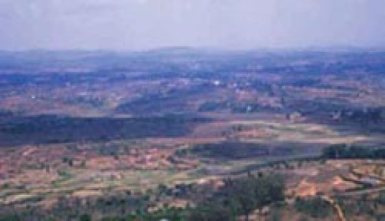
The team of Chen Xingcan of the Institute of Archaeology in Beijing, Li Liu of Stanford University in Melbourne, Australia, and Yunkuen Lee of Harvard University negotiated a permit for a project in the eastern hinterlands of Erlitou (photo, landscape in central Henan, east of Erlitou), a capital that emerged about 1800 BC. Their program had many facets, but my primary contribution has been to help with the archaeological survey.
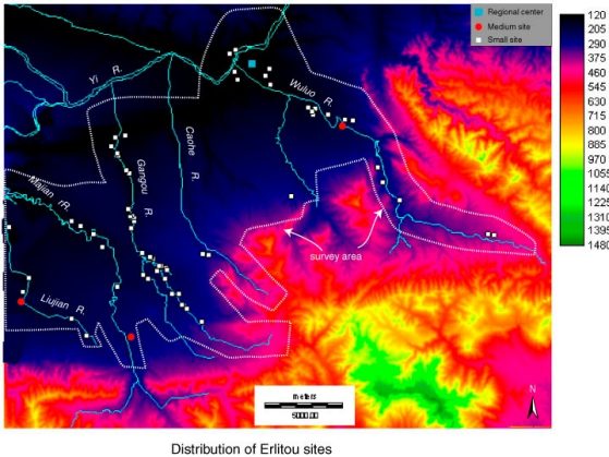
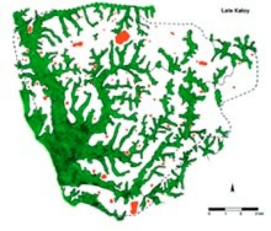
Our survey and sampling program has documented centers, villages, and hamlets dating from the Peiligang Period about 6000 BC until the second or third generation Zhou states up to about 600 BC. We are close to finishing the analysis necessary for our fist monograph, and I am working with surveys in other areas (map, distribution of Erlitou period sites in Central China).
Santa Fe
The building of comprehensive regional understandings of areas of early state emergence (and areas such as the Southeastern North America where states did not emerge, though conditions seemed ripe), both by myself and by others at the Museum of Anthropological Archaeology, is most useful when it is used to develop a more comprehensive understanding of primary state formation. Our data show that none of the simpler constructs involving a few variables proposed as explanations of such state building can account for similarities and differences in all the cases. I believe we need more complex approaches. The best hope for achieving this are the multi-variant and multi-agent models being developed at Michigan's Center for the Study of Complex Systems, the Santa Fe Institute, and related centers. Mastering the mathematics and programming on which such models are based is not easy for someone who has devoted much of a lifetime to landscapes and excavations, but the effort is necessary and I will pursue it as long as necessary.